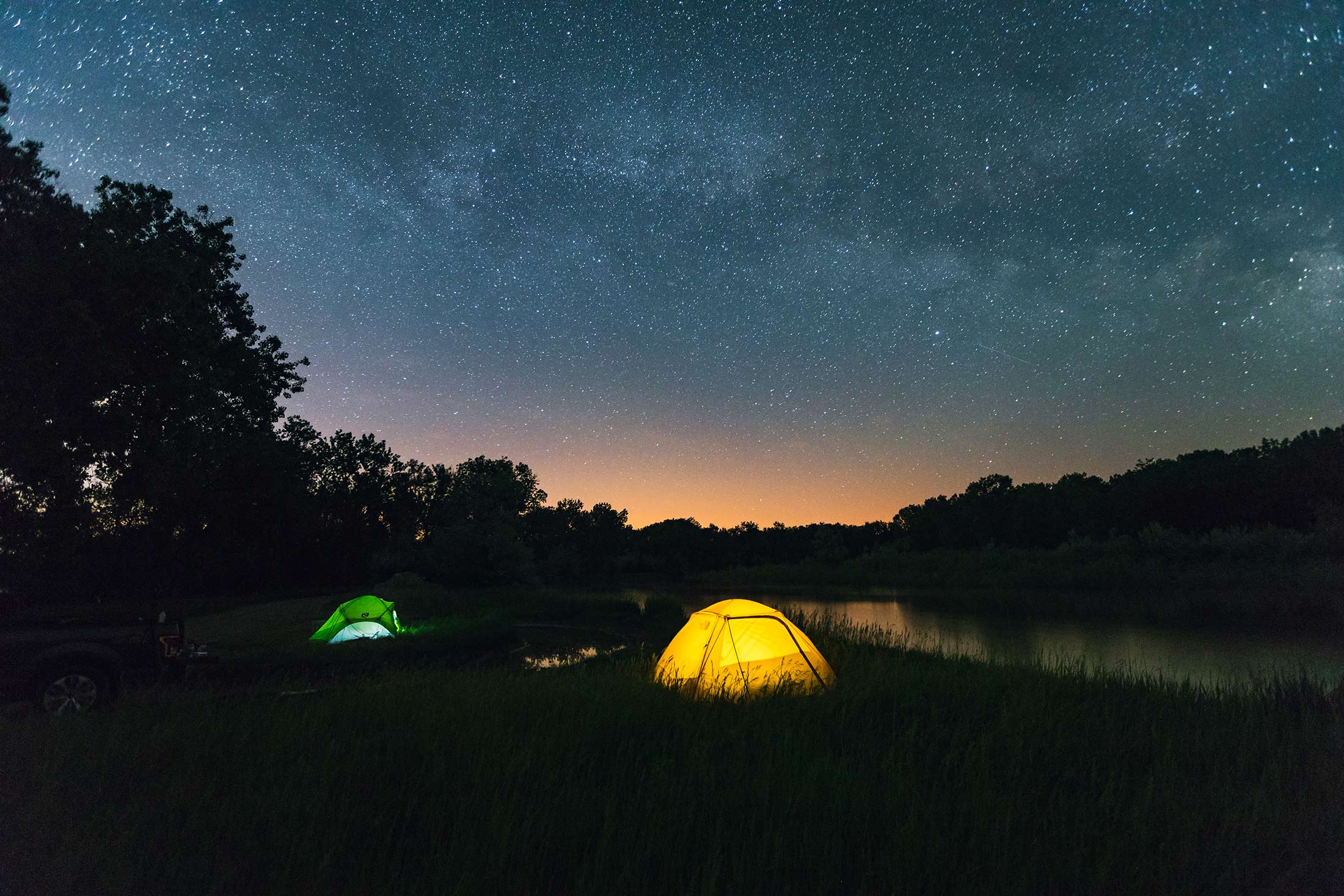
Missouri River Country offers some of the darkest skies in the Lower 48, where the Milky Way stretches horizon to horizon and stars feel close, bright and unmistakable. With minimal light pollution and wide-open landscapes, the night sky is sharp, expansive and easy to see.
If you’re new to stargazing, it can feel a little technical at first. Timing matters. Location matters. But once you understand a few basics, it’s easy to plan a night that’s a long way from ordinary.
Not all nights are equal. The darkest skies happen during a new moon, and peak viewing times often fall well after sunset.
Use a night sky calculator to find the best window during your trip — simply enter your location and date to see when conditions are optimal.
A simple app can help you make sense of what you’re seeing. Tools like SkyView let you point your phone at the sky to identify stars, planets and constellations — no cell service required.
Even in summer, temperatures drop quickly after sunset here. Plan for it. Comfort goes a long way when you’re outside for a while.
Capturing the night sky takes more than a phone and a quick snapshot. If you’re interested in photography, plan ahead — long exposures, a tripod and some technical know-how are key. Learn More Here
You don’t have to camp to see the stars. Many communities sit close enough to dark-sky areas that you can drive out, spend a few hours under the sky, then head back to a hotel. There are plenty of places to stay in Missouri River Country.
Lodging near stargazing areas:
Campgrounds make it easy to pair daytime recreation with nighttime viewing.
Public lands across the region allow for more remote experiences — just make sure you follow Leave No Trace principles.
 Pines Recreation Area, Amy Lynn Nelson
Located along Fort Peck Lake, this area offers elevated viewpoints and open sightlines, ideal for both sunset and night viewing.
South of Sidney along the Yellowstone River, this is a quieter, less-traveled spot with strong visibility and minimal nearby light.
A remote mountain range in the center of the region. Distance from towns makes this one of the darker areas available.
Set on Fort Peck Lake, this is one of the most accessible locations with consistently dark skies and nearby camping.
On the Montana–North Dakota border, this park offers a quieter setting with wide-open views and very little interference from artificial light.
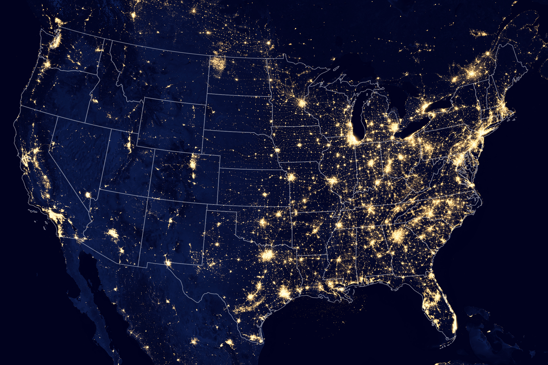 Light pollution map of the United States. Montana shows very little light pollution.
Light pollution — artificial light from towns and cities — reduces what you can see in the night sky. Even small communities can brighten the horizon.
Missouri River Country stands out because there’s very little of it.
Large portions of northeast Montana rank among the least light-polluted areas in the country. In fact, some of the most remote locations in the United States are found here, including areas near Glasgow, Scobey and Wolf Point.
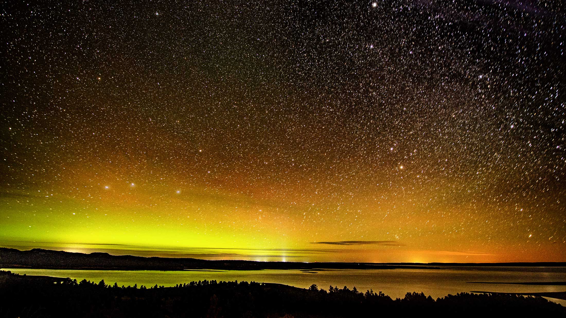
Fewer lights mean more visible stars, clearer views of the Milky Way and, at times, a chance to see the northern lights.
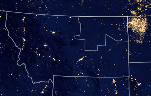 Light pollution map of Montana. Missouri River Country is outlined in the Northeast corner.

There’s more room to roam and more ways to recreate when you’re in Missouri River Country. Just remember to recreate responsibly, respect our region and stay safe.
